NEWS & RESOURCES
News & Resources
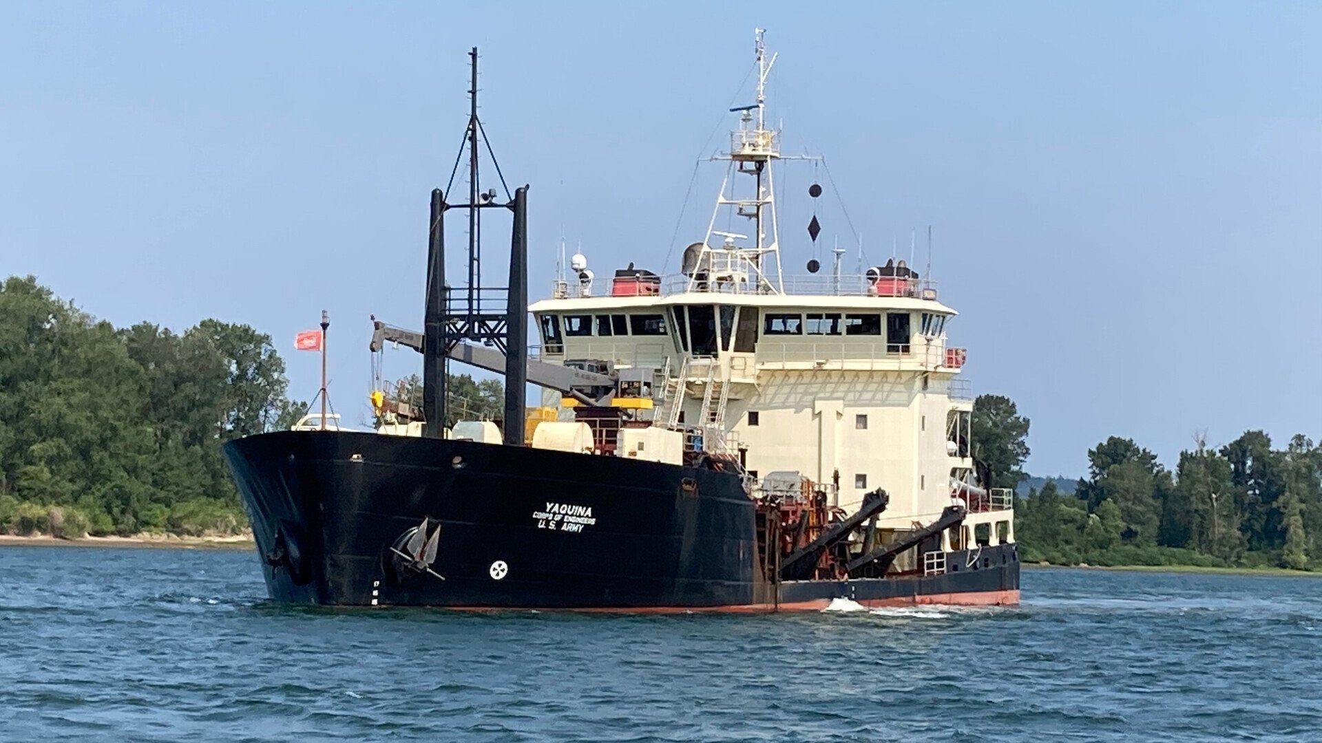
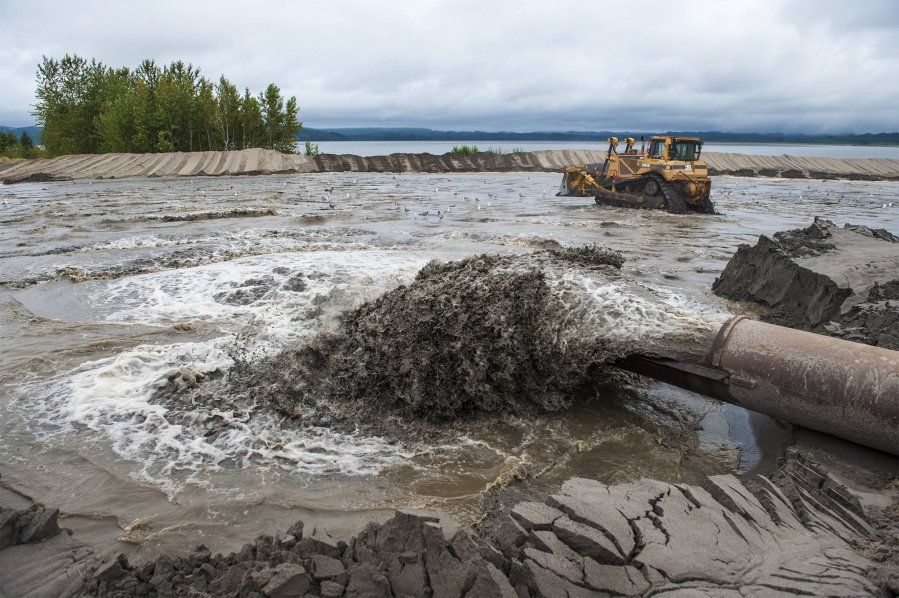
PORTLAND, Ore. -- Army planners and Columbia River sponsor ports are hosting five virtual information sessions April 26-28 to update the public on their 20-year plan for managing dredged material from the Lower Columbia River. U.S. Army Corps of Engineers’ (Corps) policy requires all federally maintained navigation projects demonstrate there is sufficient dredged material placement capacity for a minimum of 20 years. The Corps and sponsor ports are preparing a joint Environmental Impact Statement (EIS) for the plan, known as the Lower Columbia River Channel Maintenance Plan (LCR CMP) Dredged Material Maintenance Plan (DMMP). The Corps and its sponsor ports (Longview, Kalama, Woodland, Vancouver, and Portland) began the public comment period for the EIS in 2017 and are ready to update the public on their current plans. “The Lower Columbia River is a very important channel, annually moving over 50 million tons of cargo worth $24 billion, internationally,” said Sarah Knowles, project manager. “The Columbia River is ranked number one in the U.S. for wheat exports and is the third largest exporter of grain in the world.” Knowles added that the plan will allow the Corps to continue to maintain the Federal Navigation Channel until 2044. The Corps and sponsor ports invite all affected federal, state, and local agencies; Tribal Nations; and other interested parties to participate in the open houses to learn more about the 20-year placement plan. “The Port of Portland, along with other Columbia River ports, depends on maintenance dredging to support our trade gateway,” said Curtis Robinhold, Port of Portland executive director. “Maintaining the river channel at its authorized depth and width is essential to sustaining the billions of dollars of commerce that flow through the Columbia River.” Open houses: Virtual open houses will be on WebEx and feature the same content. Several options are available: Date Time More info: Tuesday, April 26 1-2:15 p.m. WebEx link Wednesday, April 27 1-2:15 p.m. WebEx link Wednesday, April 27 6:30-7:45 p.m. WebEx link Thursday, April 28 1-2:15 p.m. WebEx link Thursday, April 28 6:30-7:45 p.m. WebEx link Background: The Lower Columbia River Federal Navigation Channel project includes a main channel that is 43 feet deep and generally 600 feet wide, and that extends upstream of the Mouth of Columbia River (river mile (RM) 3) to Vancouver, WA (RM 105.5). The channel also extends into lower Oregon Slough and includes vessel turning basins at Astoria in Oregon, and at Longview, Kalama, and Vancouver in Washington. The Corps maintains the channel with a combination of dredging and pile dikes. For the past several years, the Corps has been dredging 6 to 8 million cubic yards of localized sand shoals to provide reliable service for deep-draft navigation on an annual basis. The scoping documents, Federal Register Notice of Intent, and background information are available on the project website. Presentation material will be added later. Project website: http://www.nwp.usace.army.mil/lcrchannelmaintenance/ . – 30 – Contact Chris Gaylord 503-808-4510 christopher.m.gaylord@usace.army.mil Release no. 22-012
U.S. Army Corps of Engineers removes enough sand from shipping channel annually to fill Seattle Seahawks’ CenturyLink Field twice
Resources
River facts
In 2020, over 300,000 autos were imported through ports on the Columbia River.
Deep-draft vessels on the Columbia River carried 56 million tons of cargo worth over $21 billion in 2018, making the channel a critical economic resource for our region and nation.
Shipping on the Columbia River is the most fuel-efficient, cost-effective, and safest way to move products across the Pacific Northwest. One four-barge tow on the river carries as much as 538 semi-trucks, reducing carbon emissions and roadway congestion.
60% of all U.S. wheat is transported to global markets via the Columbia River.
In 2020, 6.1 million tons of corn moved through the Columbia River, making it the second largest corn gateway in the U.S